
Marine mapping
We have substantial experience with marine mapping, primarily in Pentwater's channel and the immediate offshore area. We have experience with both conventional and side-scan sonar, and are develping some innovative tools. Here is an example of our mapping: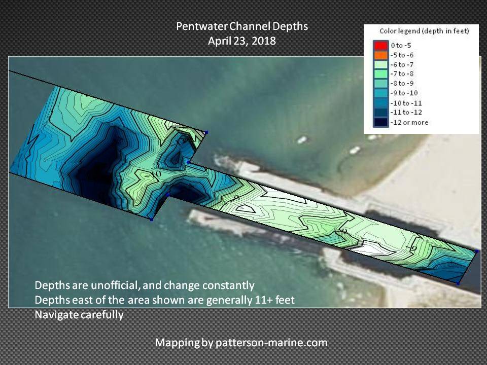
Visit our Pentwater Channel page for more information.